It might seem strange to keep such a list, but it has proven helpful when planning trips. The plan is to get to more of these places and really spend some time at each. By the way if you’re interested in the designations, click here. In short:
- Generally, a national park contains a variety of resources and encompasses large land or water areas to help provide adequate protection of the resources.
- A national monument is intended to preserve at least one nationally significant resource. It is usually smaller than a national park and lacks its diversity of attractions.
- The title national memorial is most often used for areas that are primarily commemorative. They need not be sites or structures historically associated with their subjects.
- In recent years, national historic site has been the title most commonly applied by Congress in authorizing the addition of such areas to the National Park System.
- There are also national historic landmarks, national historic landmark districts, and national historical parks. In the United States, sites are “historic”, while parks are “historical”. The NPS explains that a site can be intrinsically historic, while a park is a modern legal invention. As such, a park is not itself “historic”, but can be called “historical” when it contains historic resources. It is the resources which are historic, not the park. (Source: wikipedia.)
- And there are also battlefields, lakeshores, seashores …
Where we’ve been: Bold italic text = been there!
National Parks
38 of 63 as of 8/24/2022
| Name | Image | Location | Comments |
|---|---|---|---|
| Acadia |  | Maine 44°21’N 68°13’W  | Leaf-peeper trip in fall 1991. (Old negative scanned in …) |
| American Samoa | American Samoa 14°15″S 170°41’W | ||
| Arches |

| Utah 38°41’N 109°34’W | Driving trip Oct 2019 with Mark and Joanne Guralnick. |
| Badlands |  | South Dakota 43°45’N 102°30’W | Visited here on the Bicycle Adventures Black Hills and Badlands bike tour, in Sept 2015. |
| Big Bend |

| Texas 29°15’N 103°15’W | Aug 2016 (quicky en route to Dallas); May 2017, Sky Islands of West Texas trip. |
| Biscayne | Florida 25°39’N 80°05’W | ||
| Black Canyon of the Gunnison |  | Colorado 38°34’N 107°43’W | August 2004. |
| Bryce Canyon |

| Utah 37°34’N 112°11’W | Several, most recent and best was driving trip Oct 2019 with Mark and Joanne Guralnick. |
| Canyonlands |

| Utah 38°12’N 109°56’W | Driving trip Oct 2019 with Mark and Joanne Guralnick. |
| Capitol Reef |

| Utah 38°12’N 111°10’W | Driving trip Oct 2019 with Mark and Joanne Guralnick. |
| Carlsbad Caverns |

| New Mexico 32°10’N 104°26’W | Aug 2016, May 2017. Probably a long time ago too on a driving trip to Texas (1987 or 1988). |
| Channel Islands | 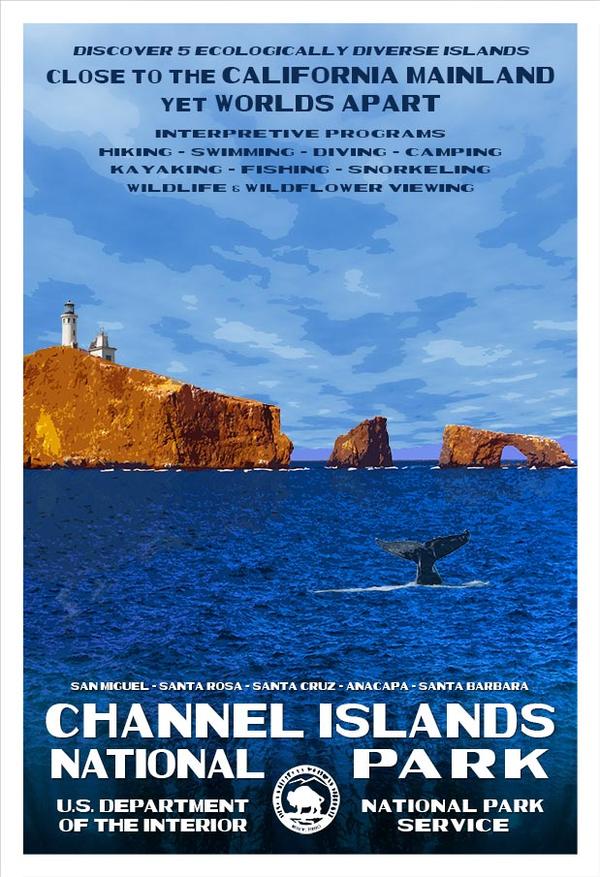 | California 34°01’N 119°25’W | Pelagic trip out of Ventura Harbor in the 1990s. |
| Congaree | South Carolina 33°47’N 80°47’W | ||
| Crater Lake |  | Oregon 42°56’N 122°06’W | Several (including photo from June 1990), last one being Sept 2017 after the Bicycle Adventures Bend Breakaway cycling tour. Very smoky from fires. |
| Cuyahoga Valley | Ohio 41°14’N 81°33’W | ||
| Death Valley | California, Nevada 36°14’N 116°49’W | ||
| Denali |

| Alaska 63°20’N 150°30’W | June 1989. Took Alaska Railroad from Anchorage there and back. |
| Dry Tortugas | Florida 24°38’N 82°52’W | ||
| Everglades |  | Florida 25°19’N 80°56’W | Stopped here en route from Venezuela (birding) to New York (concert performance at Carnegie Hall with Mansfield Chamber Singers), 1993. We remember the “summit” sign that said 3 feet! |
| Gates of the Arctic | Alaska 67°47’N 153°18’W | ||
| Gateway Arch | Missouri 38°38’N 90°11’W | ||
| Glacier |

| Montana 48°48’N 114°00’W | Sept 2018 on our Glacier-Yellowstone-Grand Tetons trip. |
| Glacier Bay | Alaska 58°30’N 137°00’W | ||
| Grand Canyon |

| Arizona 36°04’N 112°08’W | Several, but best was the rim-to-rim hike in 2010 with two nights down at Phantom Ranch. |
| Grand Teton |
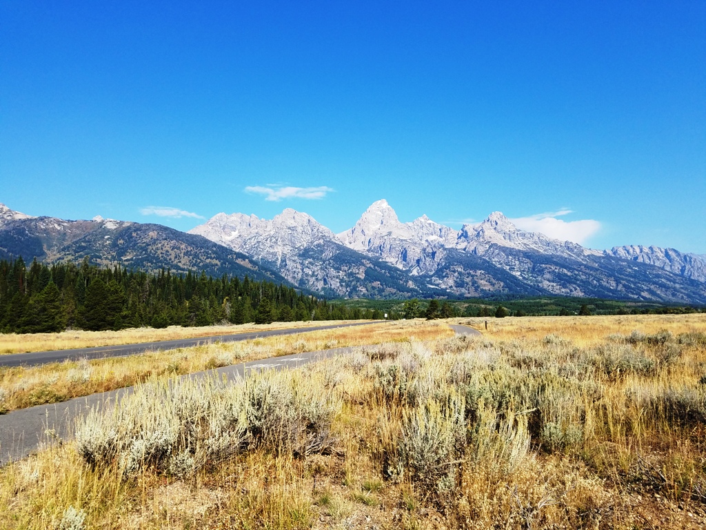
| Wyoming 43°44’N 110°48’W | Sept 2018 on our Glacier-Yellowstone-Grand Tetons trip. |
| Great Basin |

| Nevada 38°59’N 114°18’W | Aug 2017 en route to Bend for the Bicycle Adventures Bend Breakaway cycling tour. |
| Great Sand Dunes | Colorado 37°44’N 105°31’W | ||
| Great Smoky Mountains | Tennessee, North Carolina 35°41’N 83°32’W | ||
| Guadalupe Mountains |

| Texas 31°55’N 104°52’W | Aug 2016, May 2017. |
| Haleakalā |

| Hawaii 20°43’N 156°10’W | Liza rode a bike down from the top! Dec 1993. |
| Hawaiʻi Volcanoes |  | Hawaii 19°23’N 155°12’W | 10th anniversary trip, Dec 1993. |
| Hot Springs |

| Arkansas 34°31’N 93°03’W | Sept 2019 with Liza’s mom Alpha. |
| Indiana Dunes | Indiana 41°39’12″N 87°03’09″W | Became a national park in 2019; we went back in the 1980s when it was a national lakeshore. | |
| Isle Royale | Michigan 48°06’N 88°33’W | ||
| Joshua Tree |

| California 33°47’N 115°54’W | March 2017. |
| Katmai | Alaska 58°30’N 155°00’W | ||
| Kenai Fjords |
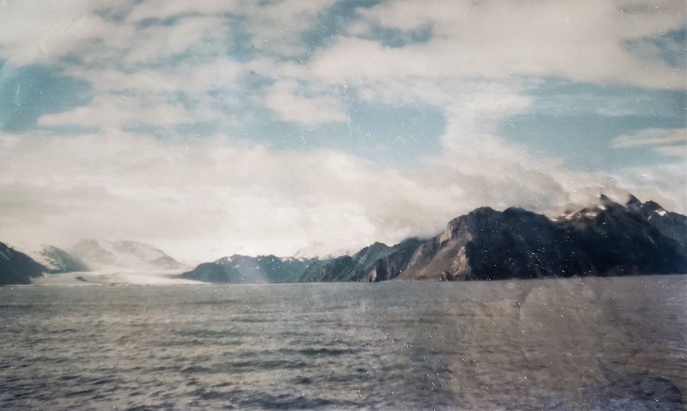
| Alaska 59°55’N 149°39’W | June 1989. |
| Kings Canyon | 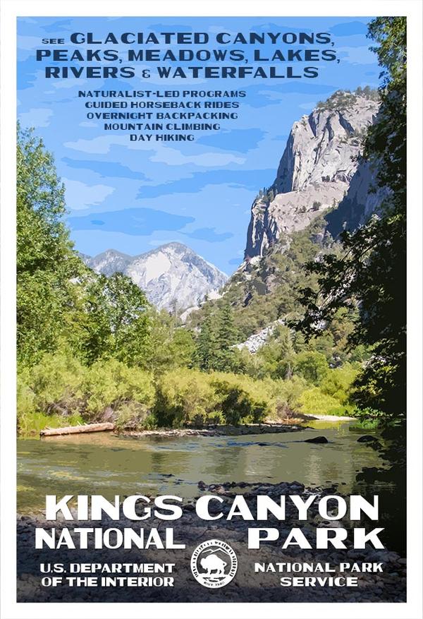 | California 36°48’N 118°33’W | A couple of camping trips in the 1980s…but no photographic evidence. 🙁 |
| Kobuk Valley | Alaska 67°33’N 159°17’W | ||
| Lake Clark | Alaska 60°58’N 153°25’W | ||
| Lassen Volcanic | 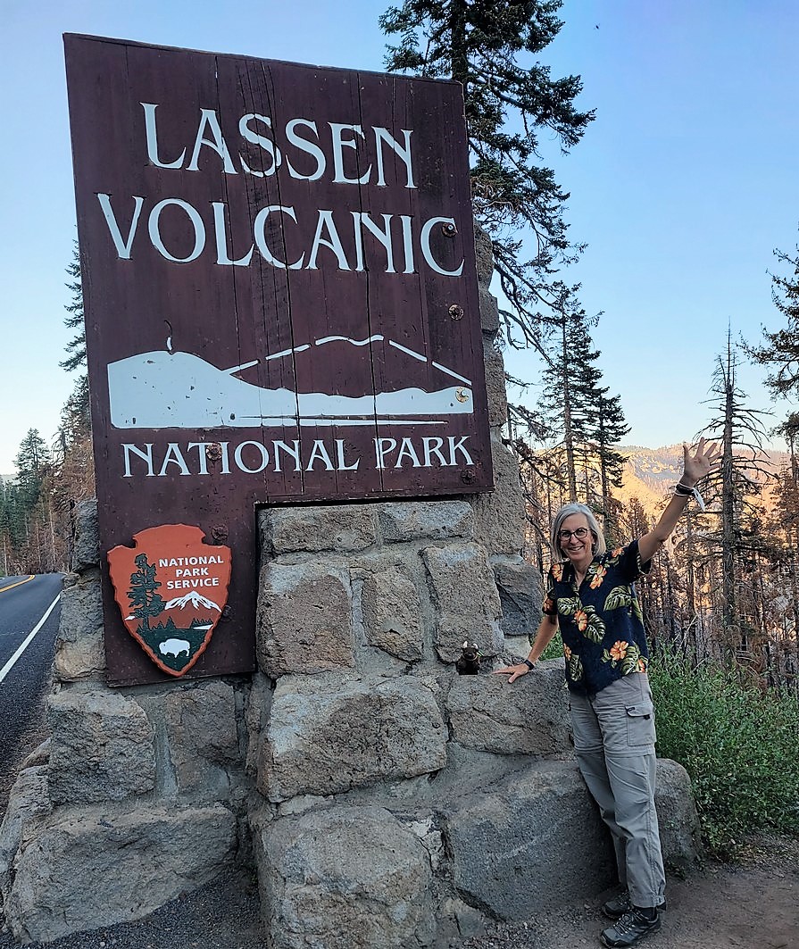 | California 40°29’N 121°31’W | SF/Oregon trip, August 2022. |
| Mammoth Cave | Kentucky 37°11’N 86°06’W | ||
| Mesa Verde |  | Colorado 37°11’N 108°29’W | August 2004. |
| Mount Rainier | Washington 46°51’N 121°45’W | ||
| New River Gorge | West Virginia | ||
| North Cascades | Washington 48°42’N 121°12’W | ||
| Olympic |  | Washington 47°58’N 123°30’W | Visited around 1990…at least the Hoh Rainforest. Haven’t been able to find any photos yet though. Same trip as Mount St. Helens perhaps. |
| Petrified Forest |

| Arizona 35°04’N 109°47’W | Southwest driving trip with Mark and Joanne Guralnick, Sept 2016. |
| Pinnacles |

| California 36°29’N 121°10’W | Aug 2017, following the Bicycle Adventures Bend Breakaway cycling tour. |
| Redwood |

| California 41°18’N 124°00’W | Aug 2017, following the Bicycle Adventures Bend Breakaway cycling tour. |
| Rocky Mountain | Colorado 40°24’N 105°35’W | ||
| Saguaro |  | Arizona 32°15’N 110°30’W | |
| Sequoia |  | California 36°26’N 118°41’W | Visited along with Kings Canyon in the 1980s…but no photographic evidence. |
| Shenandoah | Virginia 38°32’N 78°21’W | ||
| Theodore Roosevelt | North Dakota 46°58’N 103°27’W | ||
| Virgin Islands | United States Virgin Islands 18°20’N 64°44’W | ||
| Voyageurs | Minnesota 48°30’N 92°53’W | ||
| White Sands |  | New Mexico 32°47’N 106°10’W | May 2017, Sky Islands of West Texas trip; elevated from monument to park 12/20/2019. |
| Wind Cave |  | South Dakota 43°34’N 103°29’W | Visited here on the Bicycle Adventures Black Hills and Badlands bike tour, in Sept 2015. |
| Wrangell St.Elias | Alaska 61°00’N 142°00’W | ||
| Yellowstone |
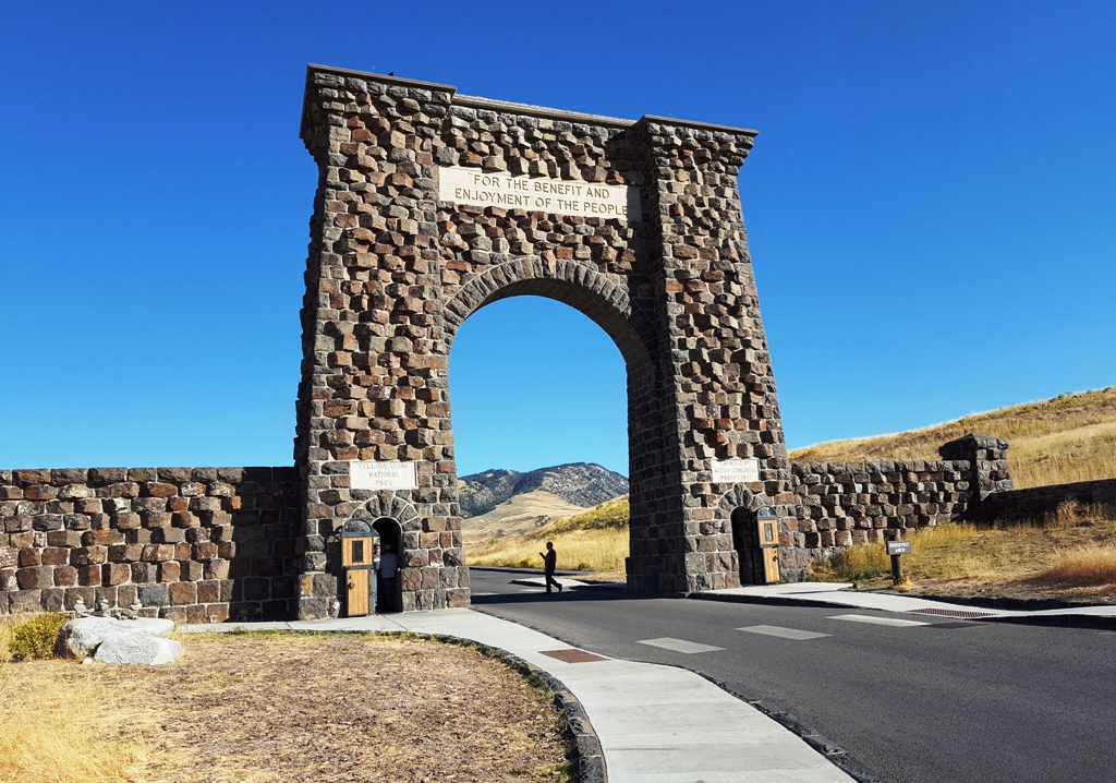
| Wyoming, Montana, Idaho 44°36’N 110°30’W | 1989, post-1988-fires. (The whole “Liza’s glasses fogged up” incident comes to mind…). More recently Sept 2018 on our Glacier-Yellowstone-Grand Tetons trip. |
| Yosemite |  | California 37°50’N 119°30’W  | Our first trip together, back in 1982; the highlight was meeting Ansel Adams in the gift shop (and had two posters signed by him)! |
| Zion |

| Utah 37°18’N 113°03’W | Oct 2016, driving trip for Conservation Lands Foundation conf in Las Vegas, NV.
Also Aug 2017, before the Bicycle Adventures Bend Breakaway cycling tour. |
National Memorials
10 of 30 as of 10/25/2019
| Name | Image | Location | Comments |
|---|---|---|---|
| Arkansas Post | Arkansas 34°01’N 91°21’W | ||
| Arlington House, The Robert E. Lee Memorial | Virginia 38°52’52″N 77°04’23″W | ||
| Chamizal | Texas 31°46’N 106°27’W | ||
| Coronado | 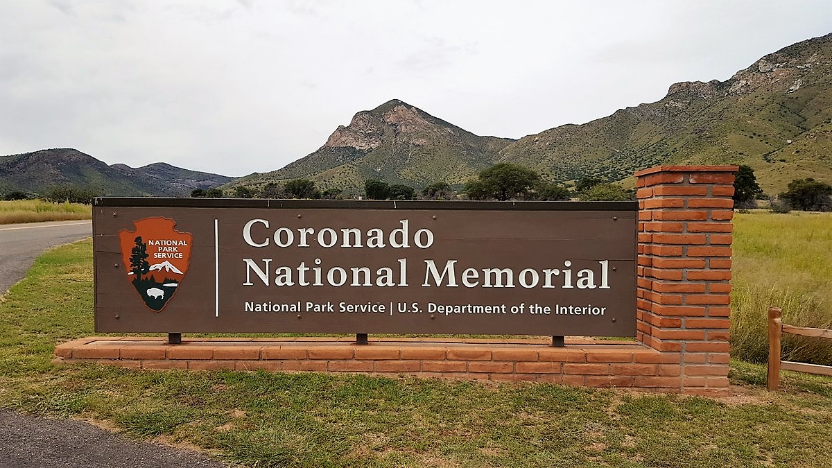 | Arizona 31°20’N 110°15’W | Our home park! |
| De Soto | Florida 27°31’N 82°38’W | ||
| Federal Hall | New York 40°42’25″N 74°00’36 ‘W | Walk-by in 2012 when visiting Guralnicks | |
| Flight 93 | Pennsylvania 40°03’18″N 78°54’04″W | ||
| Fort Caroline | Florida 30°23’10″N 81°29’53″W | ||
| Franklin Delano Roosevelt Memorial | District of Columbia 38°52’59″N 77°02’35″W | Liza on a RAND work trip in the late 1990s. | |
| General Grant | New York 40°48’47″N 73°57’47″W | ||
| Hamilton Grange | New York 40°49’16″N 73°56’49″W | ||
| Johnstown Flood | Pennsylvania 40°21’00″N 78°46’16″W | ||
| Korean War Veterans Memorial | District of Columbia 38°53’17″N 77°02’53″W | ||
| Lincoln Boyhood | Indiana 38°06’47″N 86°59’46″W | ||
| Lincoln Memorial | District of Columbia 38°53’20″N 77°03’00″W | Liza on a RAND work trip in the late 1990s. | |
| Lyndon Baines Johnson Memorial Grove on the Potomac | District of Columbia 38°52’37″N 77°03’00″W | ||
| Martin Luther King Jr. Memorial | District of Columbia 38°53’10″N 77°02’38″W | ||
| Mount Rushmore |

| South Dakota 43°52’44″N 103°27’32″W | Visited here on the Bicycle Adventures Black Hills and Badlands bike tour, in Sept 2015. |
| Pearl Harbor |

| Hawaii 21°22’N 157°57’W | Where the war started (battleship row) and ended (on the deck of the USS Missouri). Also toured the Bowfin submersible. Dec 1993. |
| Perry’s Victory and International Peace Memorial | Ohio 41°39’14″N 82°48’40″W | ||
| Port Chicago Naval Magazine | California 38°03’22″N 122°01’48″W | ||
| Roger Williams | Rhode Island 41°49’52″N 71°24’40″W | ||
| Thaddeus Kosciuszko | Pennsylvania 39°56’35″N 75°08’49″W | ||
| Theodore Roosevelt Island | District of Columbia 38°53’49″N 77°03’50″W | ||
| Thomas Jefferson Memorial | District of Columbia 38°52’52″N 77°02’13″W | Liza on a RAND work trip in the late 1990s. | |
| Vietnam Veterans Memorial | District of Columbia 38°53’28″N 77°02’53″W | Liza on a RAND work trip in the late 1990s. | |
| Washington Monument | District of Columbia 38°53’20″N 77°02’06″W | Liza on a RAND work trip in the late 1990s. | |
| World War I Memorial | District of Columbia 38°53’46″N 77°01’59″W | Liza on a RAND work trip in the late 1990s. | |
| World War II Memorial | District of Columbia 38°53’20″N 77°02’24″W | Liza on a RAND work trip in the late 1990s. | |
| Wright Brothers | North Carolina 36°00’50″N 75°40’05″W |
National Monuments
34 of 129 as of 8/24/2022.
| Name | Image | Location | Comments |
|---|---|---|---|
| Admiralty Island | Alaska 57°38’N 134°21’W | ||
| African Burial Ground | New York 40°42’52″N 74°00’15″W | ||
| Agate Fossil Beds | Nebraska 42°24’58″N 103°43’41″W | ||
| Agua Fria |

| Arizona 34°09’N 112°05’W | Oct 2019 on a AZ-UT driving trip with Mark and Joanne Guralnick. |
| Aleutian Islands World War II | Alaska 52°52’N 173°10’W | ||
| Alibates Flint Quarries | Texas 35°34’N 101°40’W | ||
| Aniakchak | Alaska 56°54’N 158°09’W | ||
| Aztec Ruins | New Mexico 36°50’N 107°00’W | ||
| Bandelier | New Mexico 35°47’N 106°16’W | Tried to go December 2018, but it was closed due to a government shutdown. | |
| Basin and Range | Nevada 37°54’N 115°24’W | ||
| Bears Ears | Utah 37°38’N 109°52’W | Skirted past it in Sept 2016 and again in Oct 2019, driving trips with Mark and Joanne Guralnick. | |
| Belmont-Paul Women’s Equality | District of Columbia 38°53’N 77°00’W | ||
| Berryessa Snow Mountain | California 39°13’N 122°46’W | ||
| Birmingham Civil Rights | Alabama 33°30’47″N 86°48’54″W | ||
| Booker T. Washington | Virginia 37°07’23″N 79°45’58″W | ||
| Browns Canyon | Colorado 38°36’54″N 106°03’32″W | ||
| Buck Island Reef | US Virgin Islands 17°47’N 64°37’W | ||
| Cabrillo | California 32°40’N 117°14’W | ||
| California Coastal | California 36°53’N 122°11’W | ||
| Camp Nelson Heritage | Kentucky 37°47’N 84°36’W | ||
| Canyon de Chelly | 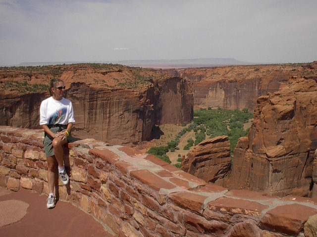 | Arizona 36°08’N 109°28’W | August 2004.
Sept 2016 on an AZ-UT driving trip with Mark and Joanne Guralnick. |
| Canyons of the Ancients | Colorado 37°22’N 109°00’W | ||
| Cape Krusenstern | Alaska 67°25’N 163°30’W | ||
| Capulin Volcano | New Mexico 36°47’N 103°58’W | ||
| Carrizo Plain | California 35°10’N 119°45’W | ||
| Casa Grande Ruins |  | Arizona 32°59’100N 111°32’W | Oct 2016, driving trip for Conservation Lands Foundation conf in Las Vegas, NV. |
| Cascade/Siskiyou | 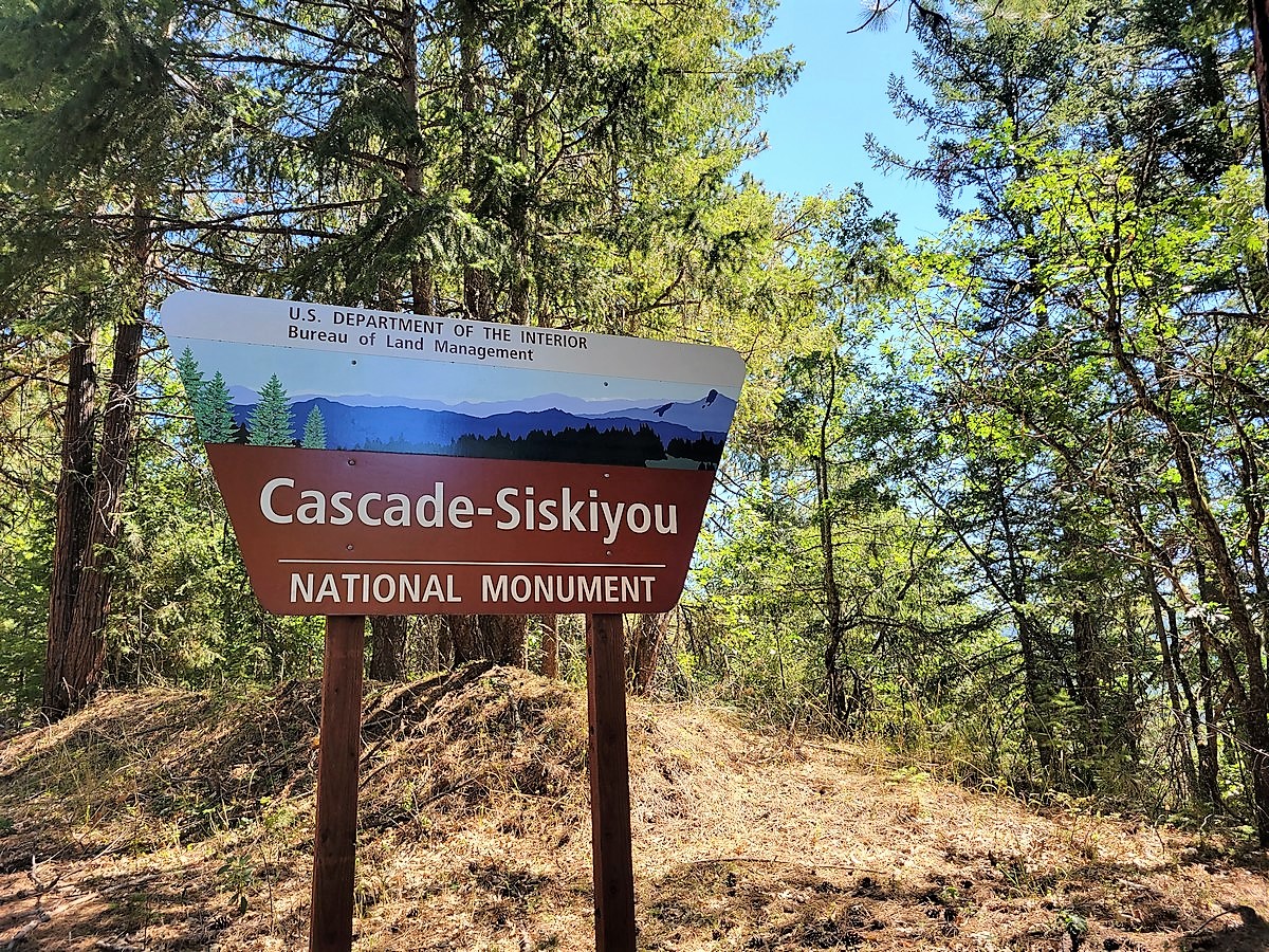 | Oregon, California 42°05’N 122°28’W | SF/Oregon trip, August 2022. |
| Castillo de San Marcos | Florida 29°53’53″N 81°18’40″W | ||
| Castle Clinton | New York 40°42’13″N 74°01’01″W | Possibly went here when visiting Mark and Joanne Guralnick in 2012? | |
| Castle Mountains | California 35°15’N 115°07’W | ||
| Cedar Breaks |  | Utah 37°38’N 112°51’W | Aug 2017, before the Bicycle Adventures Bend Breakaway cycling tour. |
| César E. Chávez | California 35°13’38″N 118°33’41″W | ||
| Charles Young Buffalo Soldiers | Ohio 39°42’26″N 83°53’25″W | ||
| Chimney Rock | Colorado 37°11’30″N 107°18’23″W | ||
| Chiricahua |  | Arizona 32°01’N 109°21’W | Driven here, bicycled… |
| Colorado | 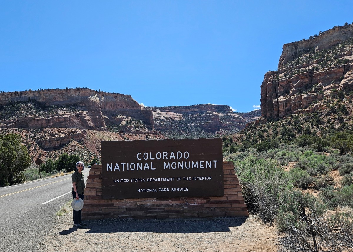 | Colorado 39°02’N 108°41’W | Dinosaur Diamond trip, Mar 2026 |
| Craters of the Moon |  | Idaho 43°25’N 113°31’W | Driving trip long ago, probably the trip to Pullman WA for a USC-WSU game. A lot of lava. |
| Devils Postpile | California 37°30’N 119°05’W | ||
| Devils Tower |
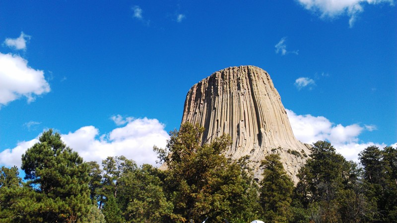
| Wyoming 44°35’N 104°43’W | Visited here on the Bicycle Adventures Black Hills and Badlands bike tour, in Sept 2015. And adopted Buddy Bison here! |
| Dinosaur |  | Colorado, Utah 40°32’N 108°59’W | Dinosaur Diamond trip, Mar 2026 |
| Effigy Mounds | Iowa 43°05’N 91°11’W | ||
| El Malpais |

| New Mexico 34°53’N 108°03’W | Dec 2018 |
| El Morro | New Mexico 35°02’N 108°21’W | ||
| Florissant Fossil Beds | Colorado 38°55’N 105°16’W | ||
| Fort Frederica | Georgia 31°13’26″N 81°23’35″W | ||
| Fort Matanzas | Florida 29°42’54″N 81°14’20″W | ||
| Fort McHenry | Maryland 39°15’47″N 76°34’44″W | ||
| Fort Monroe | Virginia 37°00’14″N 76°18’29″W | ||
| Fort Ord | California 36°38’21″N 121°44’07″W | ||
| Fort Pulaski | Georgia 32°01’37″N 80°53’24″W | ||
| Fort Stanwix | New York 43°13’05″N 75°27’32″W | ||
| Fort Union | New Mexico 35°55’30″N 105°00’32″W | ||
| Fossil Butte |

| Wyoming 41°52’N 110°46’W | Sept 2018 on our Glacier-Yellowstone-Grand Tetons trip. |
| Freedom Riders | Alabama 33°39’29″N 85°49’52″W | ||
| George Washington Birthplace | Virginia 38°11’10″N 76°55’50″W | ||
| George Washington Carver | Missouri 36°59’10″N 94°21’14″W | ||
| Giant Sequoia | California 36°02’N 118°30’W | ||
| Gila Cliff Dwellings |  | New Mexico 33°14’N 108°17’W | August 2004. |
| Gold Butte | Nevada 36°16’52″N 114°12’04″W | ||
| Governors Island | New York 40°41’28″N 74°00’58″W | ||
| Grand Canyon-Parashant | Arizona 36°24’N 113°42’W | ||
| Grand Portage | Minnesota 47°58’N 89°41’W | ||
| Grand Staircase-Escalante |
| Utah 37°24’N 111°41’W | Aug 2017, before the Bicycle Adventures Bend Breakaway cycling tour. Also again in Oct 2019 with Mark and Joanne Guralnick. |
| Hagerman Fossil Beds | Idaho 42°47’N 114°57’W | ||
| Hanford Reach | Washington 46°29’N 119°32’W | ||
| Harriet Tubman Underground Railroad | Maryland | ||
| Hohokam Pima | Arizona 33°11’N 111°55’W | ||
| Ironwood Forest |

| Arizona 32°28’N 111°34’W | November 2019. Went in on Silverbell and out on Sasco Rd, which meant crossing the Santa Cruz River and slaloming through mud. 🙁 |
| Jewel Cave | South Dakota 43°44’N 103°50’W | ||
| John Day Fossil Beds | Oregon 44°40’N 120°03’W | ||
| Jurassic | Utah 39°19’N 110°41’W | ||
| Kasha-Katuwe Tent Rocks | New Mexico 35°40’N 106°25’W | ||
| Katahdin Woods and Waters | Maine 45°58’N 68°37’W | ||
| Hovenweep | 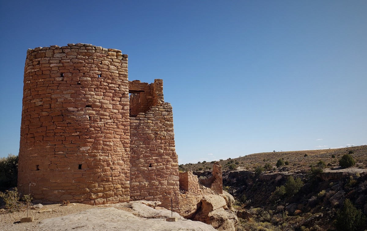 | Colorado, Utah 37°23’N 109°05’W | Driving trip Oct 2019 with Mark and Joanne Guralnick. |
| Lava Beds | 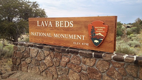 | California 41°43’N 121°31’W | Captain Jack’s Stronghold is here! mid-1980s driving to Washington? |
| Little Bighorn Battlefield | Montana 45°34’N 107°26’W | ||
| Marianas Trench Marine | Northern Mariana Islands, Guam 20°N 145’E | ||
| Medgar and Myrlie Evers Home | |||
| Military Working Dog Teams | Texas 29°23’24’N 98°37’01″W | ||
| Mill Springs Battlefield | Kentucky 37°04’N 84°44’W | ||
| Misty Fjords | Alaska 55°37’N 130°37’W | ||
| Mojave Trails | California 34°36’N 116°00’W | ||
| Montezuma Castle |

| Arizona 34°37’N 111°50’W | Driving trip Oct 2019 with Mark and Joanne Guralnick. |
| Mount St. Helens Volcanic |

| Washington 46°14’N 122°11’W | June 1990. Likely wasn’t an official national monument at that time. |
| Muir Woods | 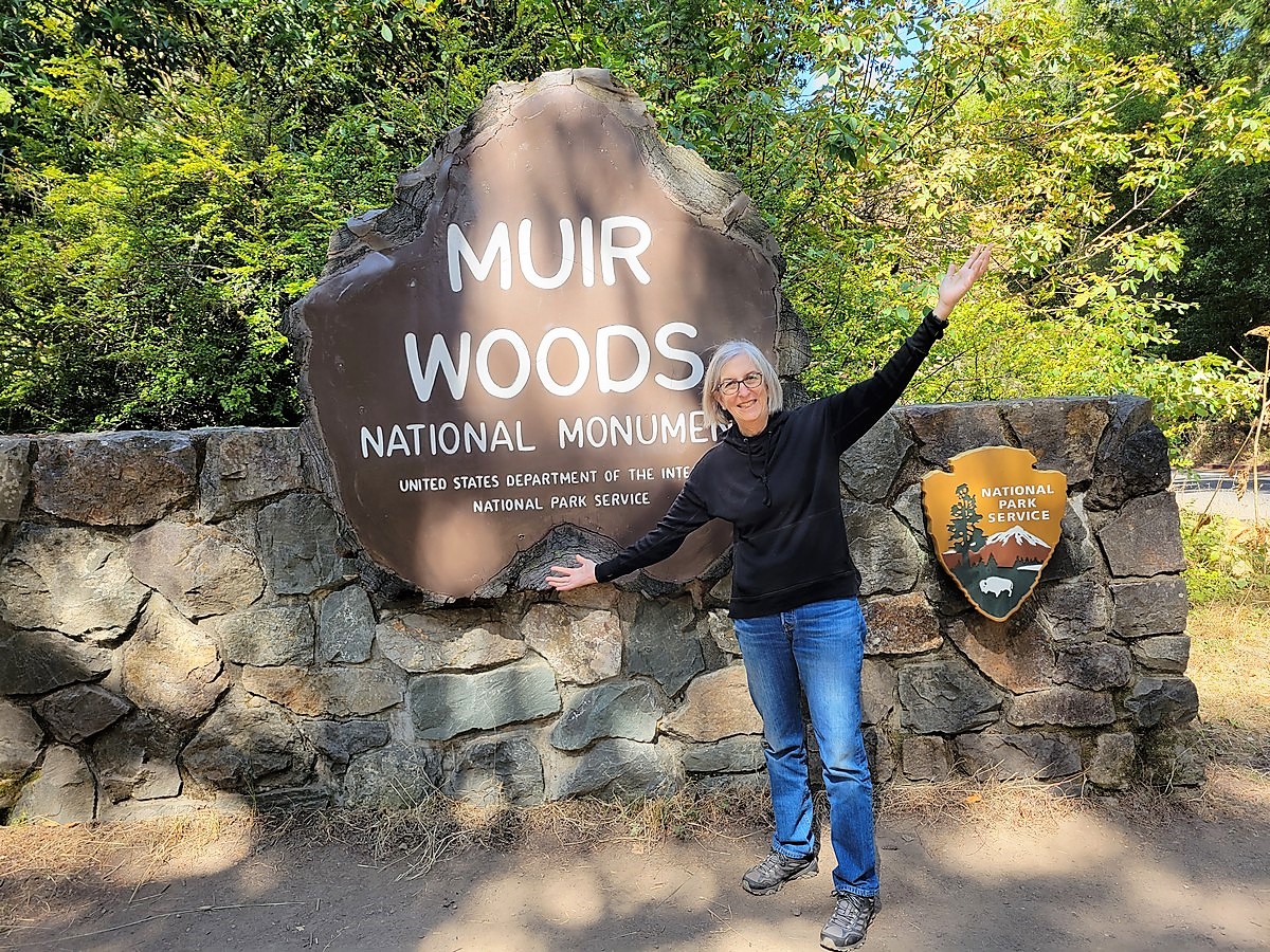 | California 37°53’N 122°35’W | SF/Oregon trip, August 2022. |
| Natural Bridges |

| Utah 37°35’N 110°00’W | Sept 2016 on an AZ-UT driving trip with Mark and Joanne Guralnick. |
| Navajo |

| Arizona 36°41’N 110°32’W | Driving trip Oct 2019 with Mark and Joanne Guralnick. |
| Newberry Volcanic | 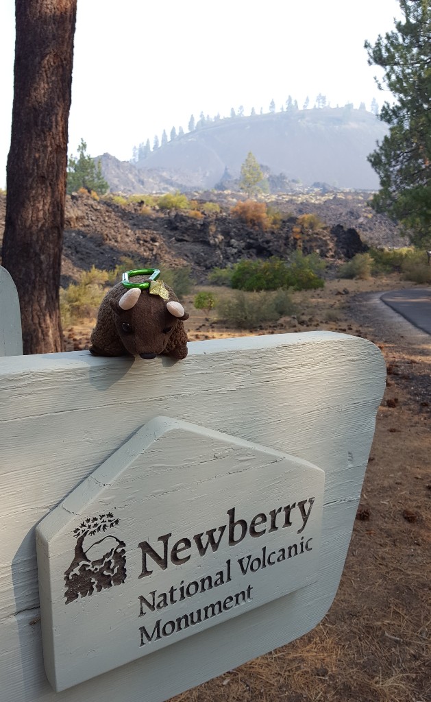 | Oregon 43°41’N 121°15’W | Aug 2017, following the Bicycle Adventures Bend Breakaway cycling tour. |
| Northeast Canyons and Seamounts Marine | Atlantic Ocean 40°24’N 68°00’W | ||
| Oregon Caves | Oregon 42°06’N 123°25’W | ||
| Organ Mountains-Desert Peaks |  | New Mexico 32°18’N 106°33’W | Apr 2021 on NM/TX trip. |
| Organ Pipe Cactus |  | Arizona 32°02’N 112°52’W | Went here and stayed in Ajo on way up to Prescott to see Bob and Pam Deichmeister. |
| Pacific Remote Islands Marine | US Minor Outlying Islands south-southwest of Hawaii 16°45’N 169°31’W | ||
| Papahānaumokuākea Marine | Hawaii, U.S. Minor Outlying Islands 25°42’N 171°44’W | ||
| Petroglyph |

| New Mexico 35°10’N 106°46’W | Dec 2018. |
| Pipestone | Minnesota 44°01’N 96°20’W | ||
| Pipe Spring |

| Arizona 36°52’N 112°44’W | Oct 2016, driving trip for Conservation Lands Foundation conf in Las Vegas, NV. |
| Pompeys Pillar | Montana 45°59’24″N 108°00’04″W | ||
| Poverty Point | Louisiana 32°38’N 91°25’W | ||
| Prehistoric Trackways | New Mexico 32°21’N 106°54’W | ||
| President Lincoln and Soldiers’ Home | District of Columbia 38°56’30″N 77°00’42″W | ||
| Pullman | Illinois 41°41’28″N 87°36’36″W | ||
| Rainbow Bridge | Utah 37°05’N 110°58’W | ||
| Río Grande del Norte | New Mexico 36°40’00″N 105°42’00″W | ||
| Rose Atoll Marine | American Samoa 14°33’S 168°32’W | ||
| Russell Cave | Alabama 34°58’N 85°48’W | ||
| Saint Francis Dam Disaster |  | California 34°33’N 118°31’W | Dec 2021. |
| Salinas Pueblo Missions |

| New Mexico 34°16’N 106°04’W | Dec 2018. |
| San Gabriel Mountains | California 34°13’N 118°04’W | ||
| San Juan Islands | Washington 48°32’N 123°02’W | ||
| Sand to Snow | California 34°05’N 116°41’W | ||
| Santa Rosa and San Jacinto Mountains | 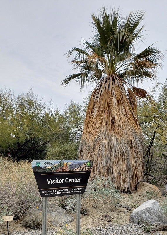 | California 33°48’N 116°42’W | Dec 2019 en route to CA |
| Scotts Bluff | Nebraska 41°50’N 103°42’W | ||
| Sonoran Desert | 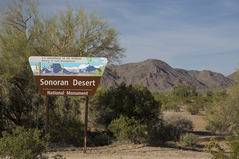 | Arizona 33°00’N 112°28’W | Pass-through every time we drive to Gila Bend |
| Statue of Liberty | New York, New Jersey 40°41’N 74°02’W | Sailed around it on a harbor tour, but didn’t go in, in 1998 or 1999 | |
| Stonewall | New York 40°44’01″N 74°00’08″W | ||
| Sunset Crater Volcano |

| Arizona 35°22’N 111°30’W | Sept 2016 on an AZ-UT driving trip with Mark and Joanne Guralnick. |
| Timpanogos Cave | Utah 40°26’N 111°43’W | ||
| Tonto | Arizona 33°39’N 111°05’W | ||
| Tule Lake | California 41°53’N 121°22’W | ||
| Tule Springs Fossil Beds | Nevada 36°19’N 115°16’W | ||
| Tuzigoot |

| Arizona 34°47’N 112°02’W | Sept 2016 on an AZ-UT driving trip with Mark and Joanne Guralnick. |
| Upper Missouri River Breaks | Montana 47°47’N 109°01’W | ||
| Vermilion Cliffs |  | Arizona 36°49’N 111°44’W | Multiple times…but most recently in Sept 2016, Oct 2019. |
| Virgin Islands Coral Reef | US Virgin Islands 18°19’N 64°43’W | ||
| Waco Mammoth | Texas 31°36’22″N 97°10’26″W | ||
| Walnut Canyon |

| Arizona 35°10’N 111°31’W | Oct 2016, driving trip for Conservation Lands Foundation conf in Las Vegas, NV. |
| Wupatki |

| Arizona 35°31’N 111°22’W | Sept 2016 on an AZ-UT driving trip with Mark and Joanne Guralnick. |
| Yucca House | Colorado 37°15’N 108°41’W |
Other National Sites
# of n as of 6/26/2020. Only places visited are listed below; there are way too many to list all of them (nearly 2600 landmarks, 58 historical parks, 89 sites…). See https://en.wikipedia.org/wiki/List_of_U.S._National_Historic_Landmarks_by_state for a list of landmarks; https://en.wikipedia.org/wiki/List_of_areas_in_the_United_States_National_Park_System#National_historic_sites for historic sites and historical parks.
NHL = National Historic Landmark; NHLD = National Historic Landmark District; NHP = National Historical Park; NHS = National Historic Site; NHT = National Historic Trail
| Name | Image | Location | Comments |
|---|---|---|---|
| Ahwahnee NHL | California 37°44′45″N 119°34′27″W | Yosemite NP | |
| Alamo NHL |  | Texas 29°25′32″N 98°29′10″W | 1988(?) road trip to TX and AR |
| Alexandria NHLD | Virginia 38°48′12″N 77°02′47″W | Many visits with Bob & Pam Deichmeister | |
| Apollo Mission Control Center NHL | Texas 29°33′23″N 95°05′18″W | Liza went in 1977 (Bluebonnet Bowl); we went together in the late 80s | |
| Bonneville Dam NHLD |  | Washington, Oregon 45°38′38″N 121°57′42″W | Sept 2014 when in Oregon for Robert Mosher wedding |
| Cape May Historic District NHL | 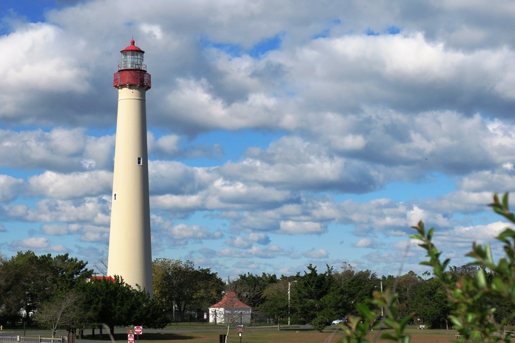 | New Jersey 38°56′13″N 74°54′40″W | Sept 1995 (PA Dutch cycling trip); Oct 2018 |
| Dealey Plaza NHLD | Texas 32°46′43″N 96°48′30″W | Liza first went with Lindsey and Jackie in the 70s | |
| Durango-Silverton Narrow-Gauge Railroad NHL |  | Colorado 37°17′51″N 107°42′39″W | Aug 2004 |
| Fort Bowie and Apache Pass NHS |

| Arizona 32°08′46″N 109°26′08″W | June 2020, COVID-19 day trip |
| El Tovar NHL | Arizona 36°03′21″N 112°08′13″W | Grand Canyon south rim, strolled through | |
| Fort Davis NHS | 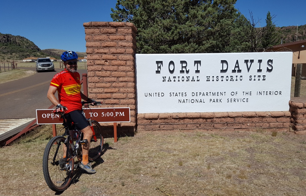 | Texas 30°35′57″N 103°53′34″W | May 2017 |
| Fort Huachuca NHL | 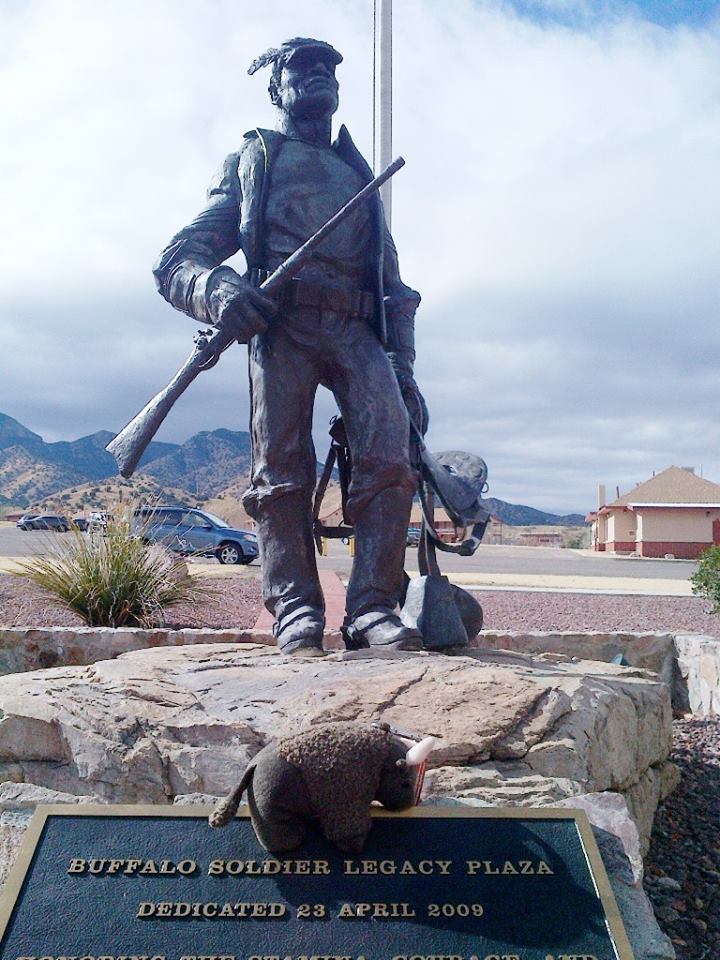 | Arizona 31°33′19″N 110°20′59″W | LOL Liza worked here! |
| Grand Canyon Lodge NHL |  | Arizona 36°11′57″N 112°03′07″W | Rim-to-rim hike Oct 2010 |
| Hoover Dam NHL |  | Arizona 36°00′56″N 114°44′16″W | Oct 2016 |
| Hubbell Trading Post NHS | 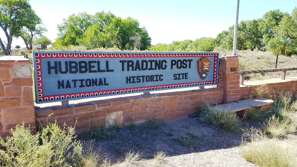 | Arizona 35°43′32″N 109°35′36″W | Sept 2016 |
| Independence NHP |  | Pennsylvania | Liberty Bell, etc., 1995 as part of PA Dutch cycling trip |
| Juan Bautista de Anza NHT |  | Nogales, Arizona to San Francisco, California | 1200 miles! We hiked a small bit near Tubac, AZ, August 2020 |
| Jerome Historic District NHL |  | Arizona 34°45′13″N 112°06′41″W | Road trip with Mark and Joanne Guralnick |
| Lehner Mammoth-Kill Site NHL | Arizona 31°26′00″N 110°06′00″W | Robert has been; Liza and Buddy need to visit | |
| Library of Congress NHL | District of Columbia 38°53′20″N 77°00′16″W | Liza went here ~ 1976? | |
| Los Alamos Scientific Laboratory NHLD |  | New Mexico 35°52′32″N 106°19′27″W | Road trips, latest Dec 2018 |
| LA Memorial Coliseum NHL |  | California 34°00′50″N 118°17′16″W | Many football games starting in 1974! |
| Lowell Observatory NHL |  | Arizona 35°12′10″N 111°39′52″W | Aug 2017 on way to Bend OR; Oct 2019 (Guralnicks) |
| Lower Klamath National Wildlife Refuge NHL | California, Oregon 41°58′00″N 121°46′00″W | ||
| Minute Man NHP |  | Massachusetts 42°27′11″N 71°17′55″W | Leaf-peeper trip in 1991 |
| Mission Santa Inés NHL | California 34°35′40″N 120°08′12″W | Solvang | |
| Monticello NHL | Virginia 38°00′30″N 78°27′12″W | Thomas Jefferson House, Liza visited in 1999 | |
| Montpelier NHL | Virginia 38°13′11″N 78°10′10″W | James Madison House, Liza visited in 1999 | |
| Mount Vernon NHL | Virginia 38°42′28″N 77°05′10″W | George Washington House, Liza last visited in 1999 | |
| Murray Springs Clovis Site NHL | Arizona 31°34′14″N 110°08′27″W | Robert has been; Liza and Buddy need to visit | |
| Pentagon NHL | Virginia 38°52′16″N 77°03′21″W | RAND visits | |
| Phelps Dodge General Office Building NHL | Arizona 31°26′25″N 109°54′41″W | Bisbee Mining and Historical Museum | |
| Rockefeller Center NHL | 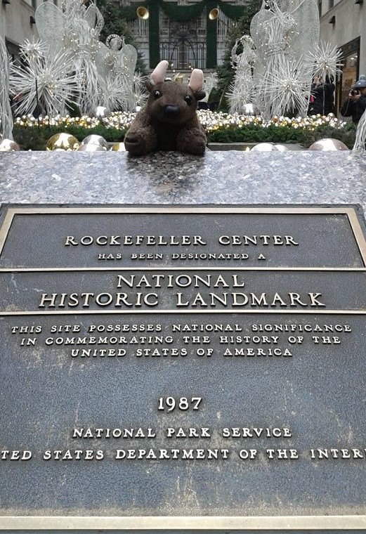 | New York 40°45′31″N 73°58′45″W | Dec 2016 |
| Rose Bowl NHL |  | California 34°09′34″N 118°10′00″W | Pasadena |
| San Francisco Cable Cars NHL | California 37°47′44″N 122°24′27″W | Liza, first band trip to SF in 1977 | |
| San Xavier del Bac Mission NHL | Arizona 32°06′25″N 111°00′29″W | Long before we moved to Arizona… | |
| Santa Monica Looff Hippodrome NHL | California 34°00′37″N 118°29′47″W | AKA the carousel building on the Santa Monica pier | |
| Silverton NHLD | 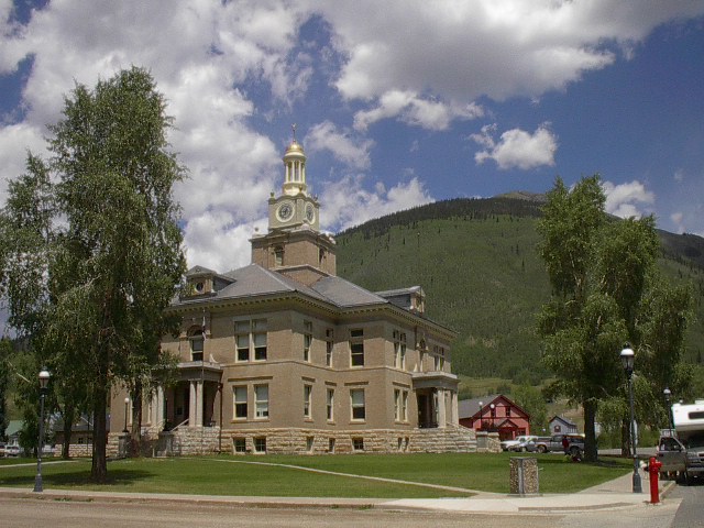 | Colorado 37°48′45″N 107°39′47″W | August 2004 |
| Texas State Capitol NHL | Texas 30°16′22″N 97°44′28″W | Said to be just a teeny bit taller than the US Capitol | |
| Titan Missile Museum NHL | Arizona 31°54′05″N 110°59′54″W | ||
| Tombstone NHLD | Arizona 31°42′45″N 110°03′59″W | Blech | |
| Tumacácori NHP | 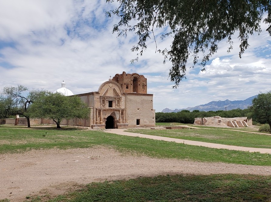 | Arizona 31.5681465°N 111.0506458°W | Stopped once for a chile festival in 2017? Proper visit in August 2020 |
| USS Arizona NHL | 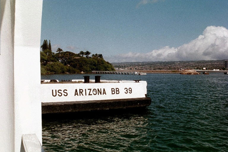 | Hawaii 21°22′00″N 157°57′10″W | Pearl Harbor, Oct 2000 |
| USS Bowfin NHL | 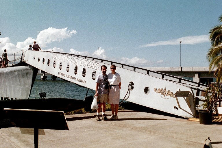 | Hawaii 21°22′20″N 157°56′30″W | Pearl Harbor, Oct 2000 |
| Valley Forge NHP |  | Pennsylvania 40°05′49″N 75°26′20″W | November 2018 for Wanerman wedding |
| White House NHL | District of Columbia 38°53′52″N 77°02′12″W | Liza went here ~ 1976? |
© Liza and Robert Weissler aves.org 2000-2026, licensed under the
Creative Commons Attribution ShareAlike 4.0 International License.